Teaching Notes
This unit uses the book "The Great Kapok Tree" by Lynne Cherry as a central text. It is predominantly a Geography Inquiry but offers some opportunities to explore content and skills in other Australian Curriculum Year 4 subject areas including Science, English and Mathematics.
Biomes of the World
Before exploring the Amazon Rainforest specifically, preliminary activities allow students to review prior understanding and build background knowledge about the world, mapping conventions and different vegetation types.
Continents and Oceans
Review students' knowledge about lines of latitude, continents and oceans using the quick quiz linked to the "Biomes" page and a world map showing the continents and major lines of latitude. If students do not recall the continents and oceans, there is a simple tutorial linked to the Biomes page for independent study.
Biomes of the World
Students visit information pages and watch short videos to learn about the different biomes of the world. They take notes using a table to record key words that describe the biome and its climate, as well as the plants and animals that are found in that biome.
To break up the task, students are assigned two or three biomes to investigate and then pair up with someone who was assigned different biomes to investigate so they can share their notes. The table can be filled out over multiple sessions.
This is an opportunity to encourage students to be succinct in their notetaking and to just record keywords rather than copying chunks of text. They can use their notes to write a paragraph(in their own words) that describes a biome.
World Map
Students copy the World Map into Paint (or a similar program) and colour the different regions by looking at the maps linked to the Biomes page. There is a complete biome map on that website for students to check their work. This activity is a good opportunity for students to identify patterns of vegetation (ACHGS030) and to represent features on maps (ACHGS029). It is also helps to develop skills that will be used in an assessment piece later in this unit.
Extension Activities
For students who have a particular interest in exploring biomes further or who complete the other activities very quickly, a number of other websites are linked to the bottom of the page.
Engage
Note-taking
Read the story of The Great Kapok Tree to the students. Discuss some of the themes that come out of this first reading and questions the students now have. Students reread the book or listen to the story being read as they make notes about all of the animals introduced in the story and the reasons they give the woodcutter for saving the tree. The notetaking template can be downloaded via the page.
Finding the main idea
Students watch a short video about the "finding the main idea" reading comprehension strategy and use this strategy as a class to discover the main idea of The Great Kapok Tree.
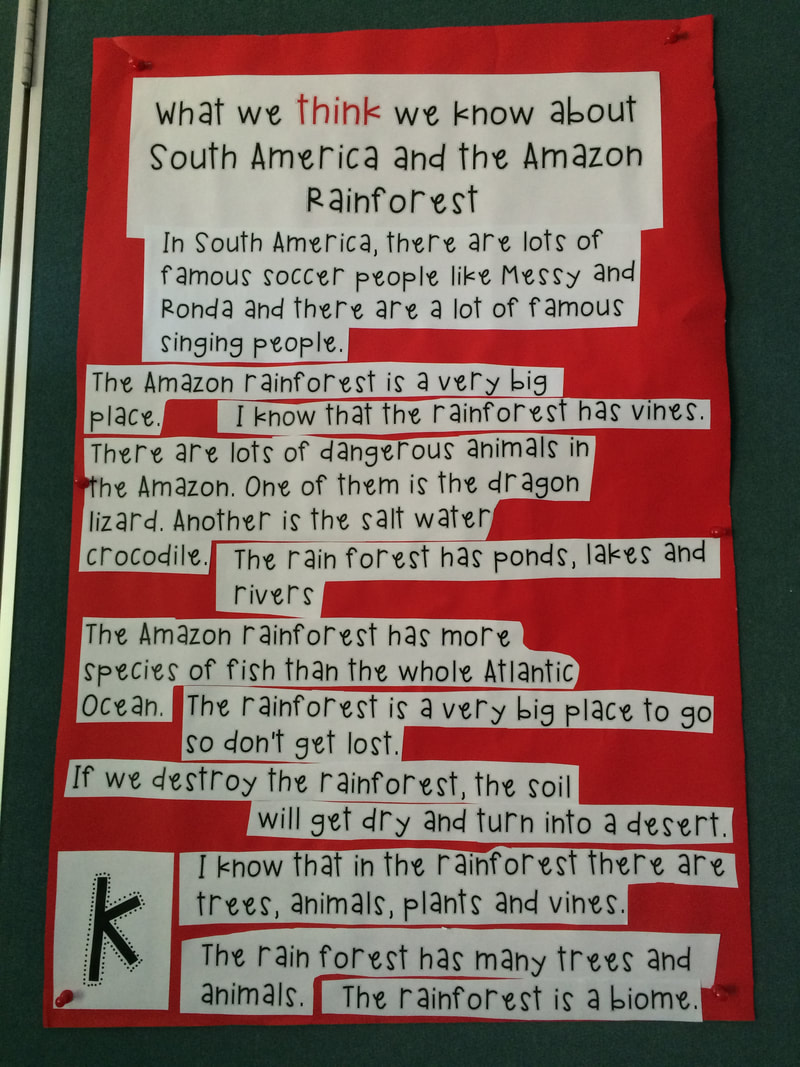
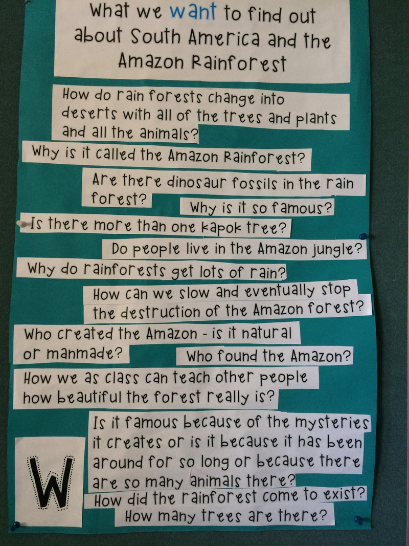
Recalling Prior Knowledge
Students write their current conceptions and wonderings about South America, the Amazon Rainforest, and rainforests in general, on sticky notes (using Linoit.com or paper notes). Create a class KWL Chart using the students thoughts and questions.
Read the story of The Great Kapok Tree to the students. Discuss some of the themes that come out of this first reading and questions the students now have. Students reread the book or listen to the story being read as they make notes about all of the animals introduced in the story and the reasons they give the woodcutter for saving the tree. The notetaking template can be downloaded via the page.
Finding the main idea
Students watch a short video about the "finding the main idea" reading comprehension strategy and use this strategy as a class to discover the main idea of The Great Kapok Tree.
Recalling Prior Knowledge
Students write their current conceptions and wonderings about South America, the Amazon Rainforest, and rainforests in general, on sticky notes (using Linoit.com or paper notes). Create a class KWL Chart using the students thoughts and questions.
The Purposes of Texts
When reading and rereading The Great Kapok Tree throughout the unit, discuss the purposes of this text. How does this text entertain? What features of a narrative or story does it have? (e.g. animals that can speak, orientation/complication/resolution structure) How does this text inform? (e.g. end papers, map, names of animals around borders, through illustrations, through explanations from animals) How does this text persuade? (Read the message from the author. Why did the author write this book?)
When reading and rereading The Great Kapok Tree throughout the unit, discuss the purposes of this text. How does this text entertain? What features of a narrative or story does it have? (e.g. animals that can speak, orientation/complication/resolution structure) How does this text inform? (e.g. end papers, map, names of animals around borders, through illustrations, through explanations from animals) How does this text persuade? (Read the message from the author. Why did the author write this book?)
Explore
South America is made up of many countries
Students explore the location of the countries of South America using maps, both online and in atlases. They read, write, order and compare larger numbers in the context of South America (populations, land area etc)
Students explore the location of the countries of South America using maps, both online and in atlases. They read, write, order and compare larger numbers in the context of South America (populations, land area etc)
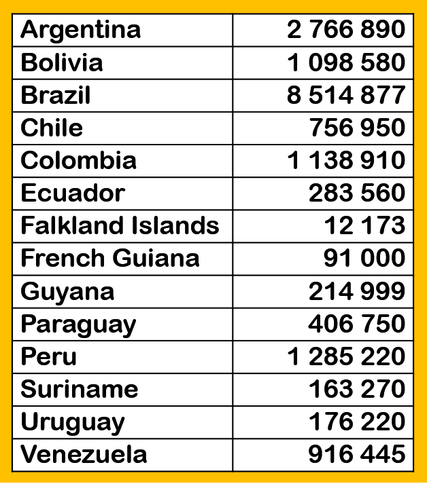
Land area of South American countries in square kilometres. Information from Wikipedia, April 2015
|
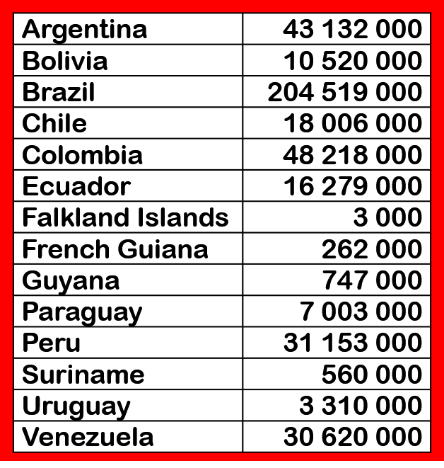
Population of South American countries.
Information from Wikipedia, April 2015
|
|
Learning about Rainforests
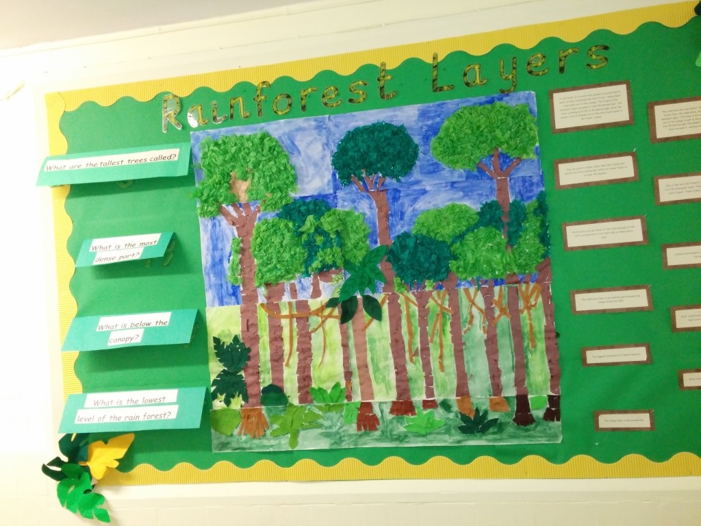
Students use the information on the Learning about Rainforests webpage to help answer the questions and to complete the tasks in the Word document. If desired, the class could create a display about rainforests showing the different layers of the rainforest and the animals that live in the Amazon. (For an example, visit Teaching Photos) A Virtual Visit to the Amazon
Students visit a number of websites to discover more about the Amazon rainforest. They make a Kizoa presentation to put together some ideas about things they would see if they were to visit. Students should include a map of the Amazon, some images and short text in their presentation. |
|
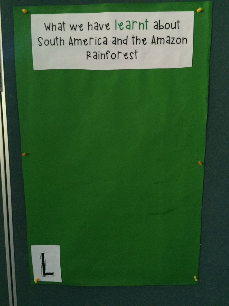
KWL Chart
Students brainstorm things that they think they know and want to find out about the Amazon Rainforest and add things that they learn through the study to the KWL chart.
Students brainstorm things that they think they know and want to find out about the Amazon Rainforest and add things that they learn through the study to the KWL chart.
Mapping South America
Students learn about cartographic conventions using Atlases and online maps and tools. They undertake a series of short acitivities to become more familiar with the countries of South America and the vegetation types.
Atlas Activity 1
Look at a map of South America in an atlas. Construct a table showing the grid references for the location of each country on this map. There will be more than one grid reference for each country. (Students might work in teams of three to split the task and then share their findings in the small group.)
Atlas Activity 2
Write five sentences that describe the relative location of the countries of South America. Mention at least three countries in each sentence. (e.g. Bolivia is west of Brazil but north of Paraguay.)
Atlas Activity 3
Use the index of the atlas to locate places in South America. Record your findings in a table using these headings: Feature, Grid reference, Country/Countries. (Students may need to visit the Wikipedia pages linked to each image to find out more about the location. From Wikipedia, they can visit Google Maps if a more precise location is required before referring to the atlas to determine the grid reference for their map.)
Atlas Activity 4
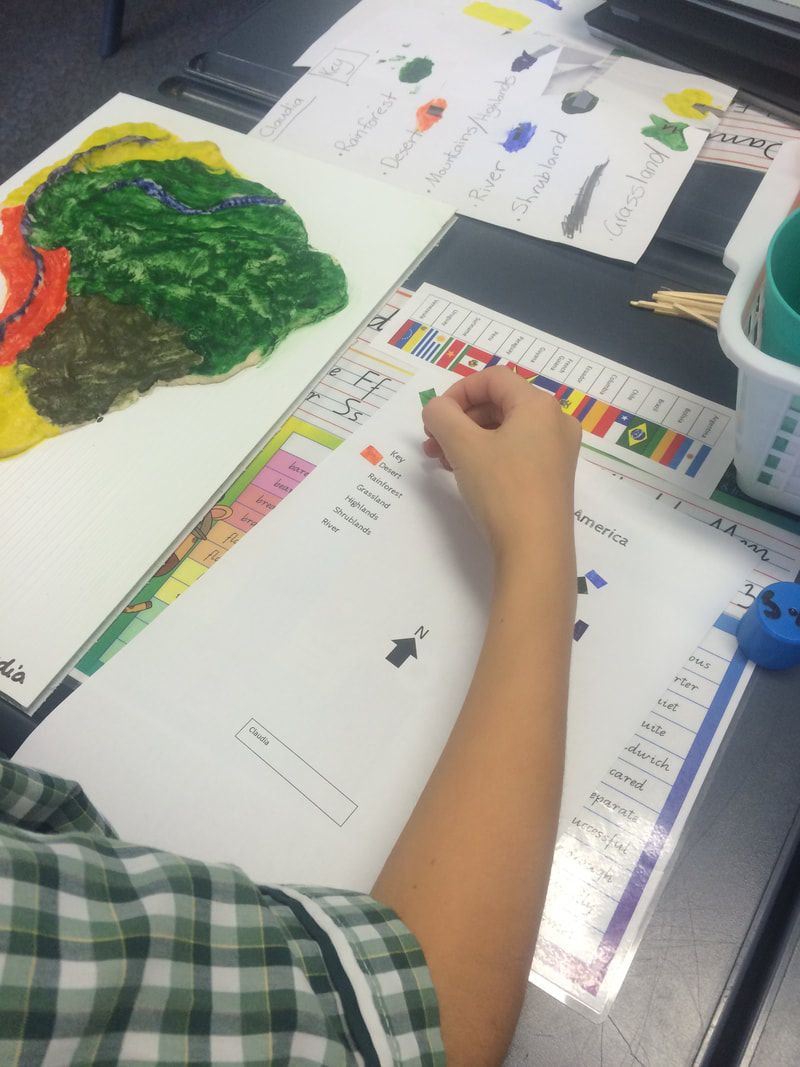
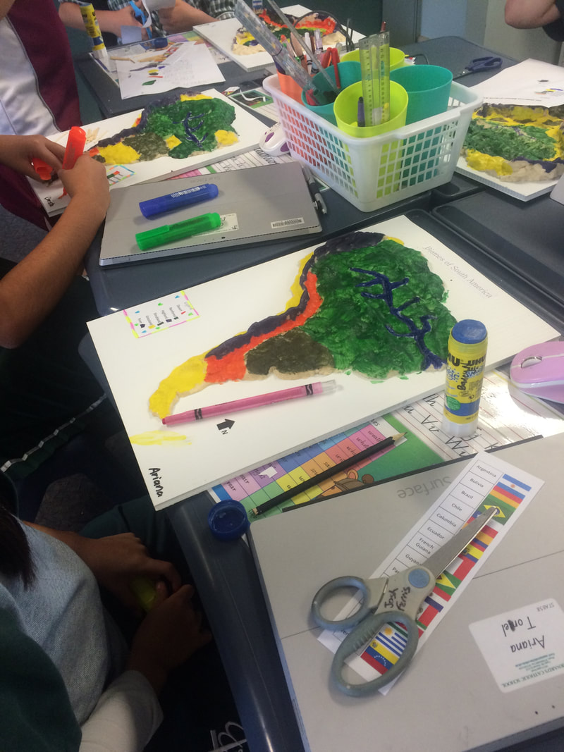
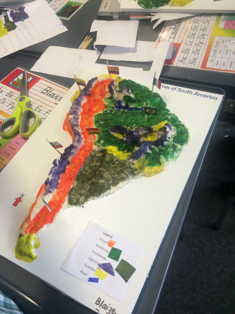
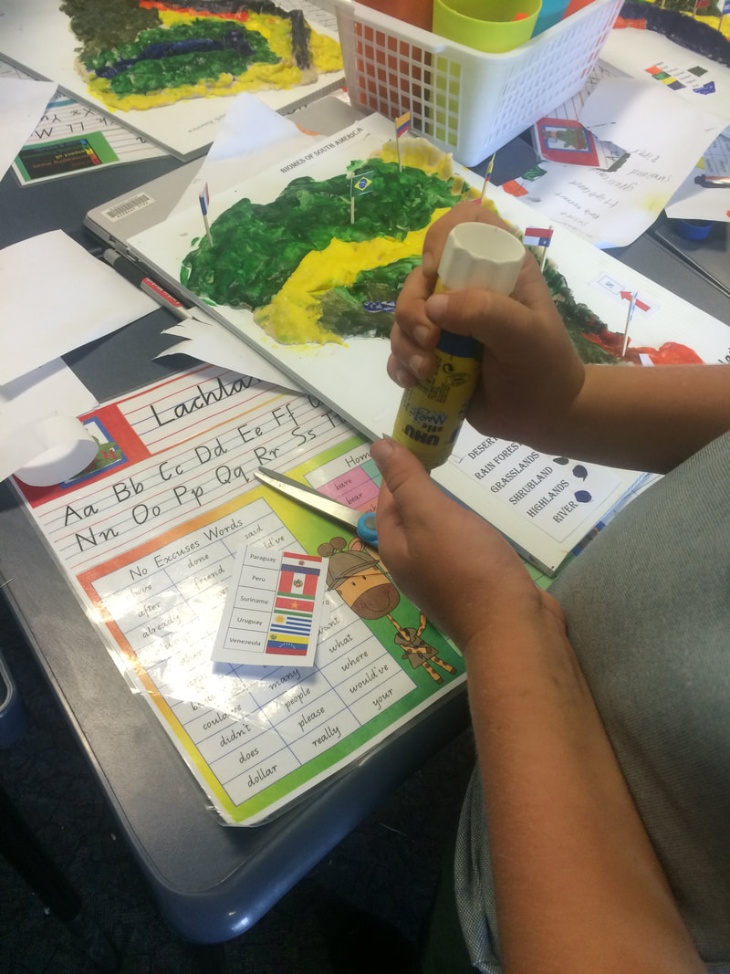
Look at the maps of South America in your atlas to see the different types of vegetation in South America. Using the outline map, create a map to show the different vegetation regions in South America. Make sure to include a legend, title and north point on your map.
Students learn about cartographic conventions using Atlases and online maps and tools. They undertake a series of short acitivities to become more familiar with the countries of South America and the vegetation types.
Atlas Activity 1
Look at a map of South America in an atlas. Construct a table showing the grid references for the location of each country on this map. There will be more than one grid reference for each country. (Students might work in teams of three to split the task and then share their findings in the small group.)
Atlas Activity 2
Write five sentences that describe the relative location of the countries of South America. Mention at least three countries in each sentence. (e.g. Bolivia is west of Brazil but north of Paraguay.)
Atlas Activity 3
Use the index of the atlas to locate places in South America. Record your findings in a table using these headings: Feature, Grid reference, Country/Countries. (Students may need to visit the Wikipedia pages linked to each image to find out more about the location. From Wikipedia, they can visit Google Maps if a more precise location is required before referring to the atlas to determine the grid reference for their map.)
Atlas Activity 4
Look at the maps of South America in your atlas to see the different types of vegetation in South America. Using the outline map, create a map to show the different vegetation regions in South America. Make sure to include a legend, title and north point on your map.
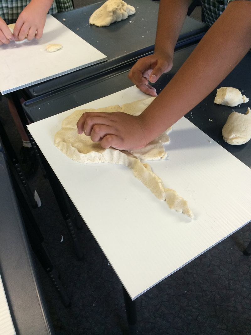
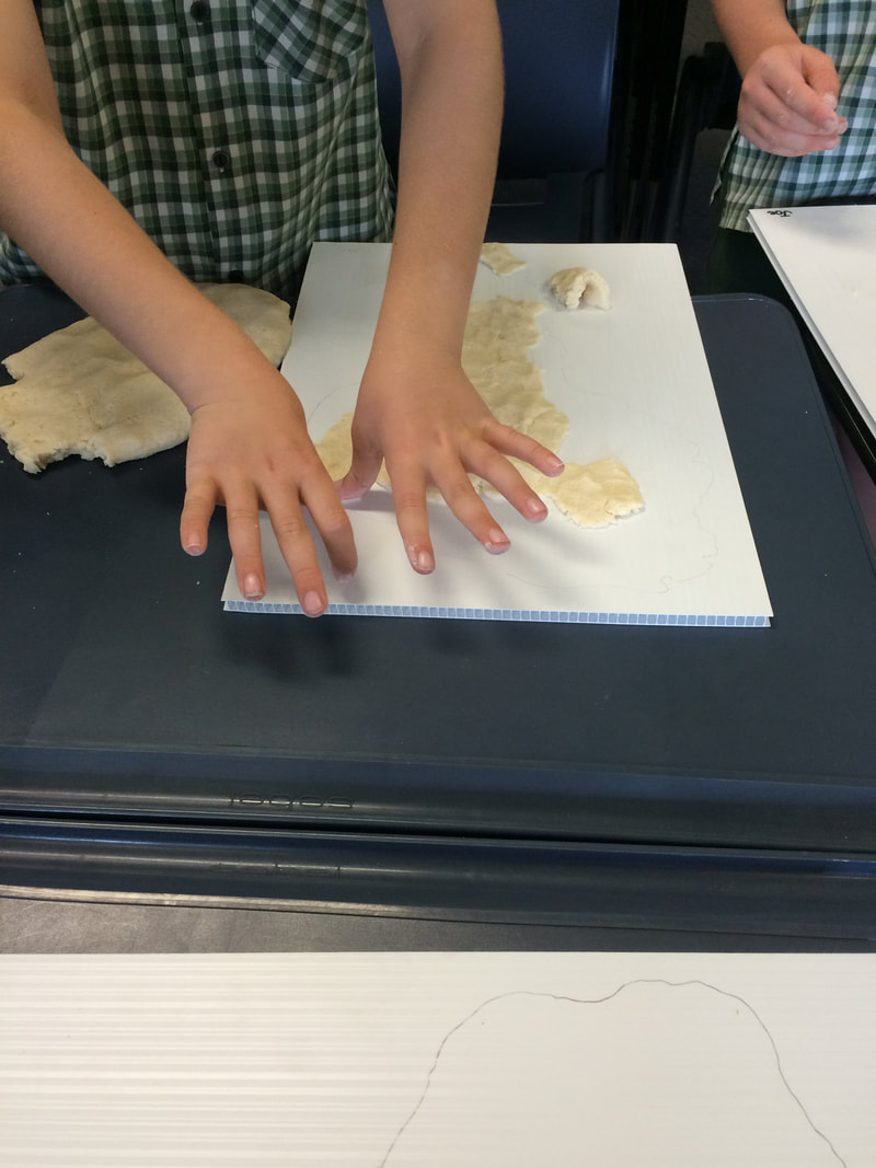
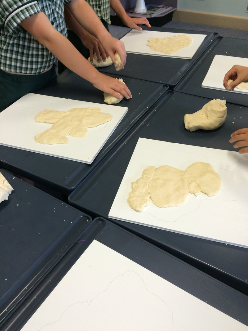
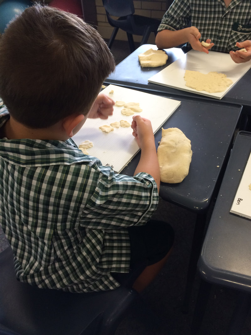
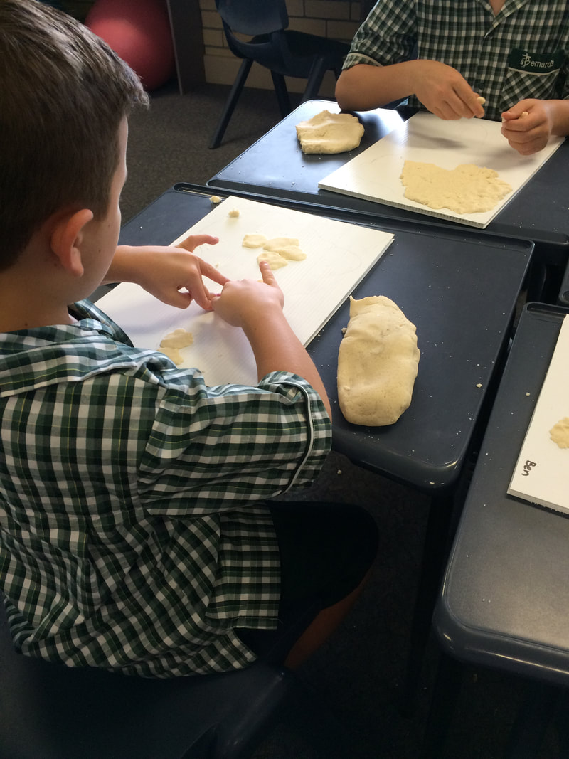
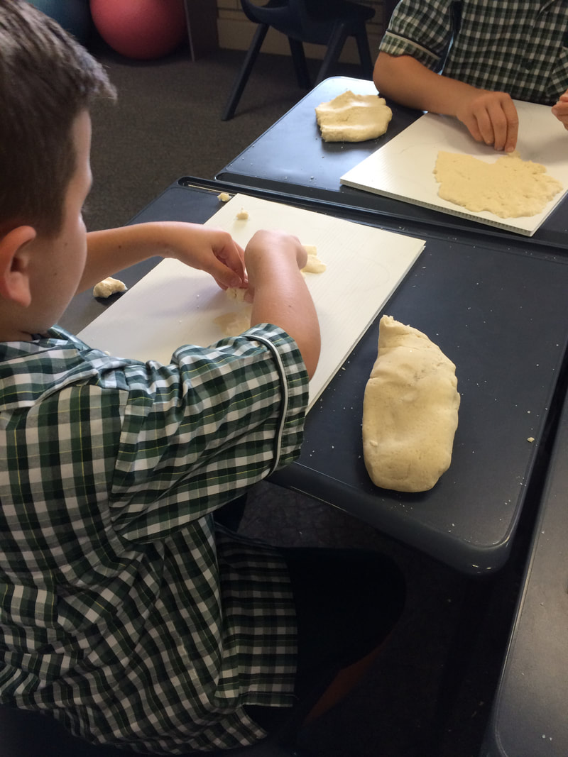
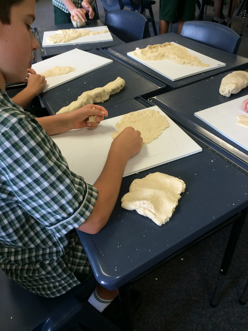
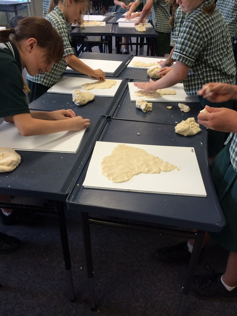
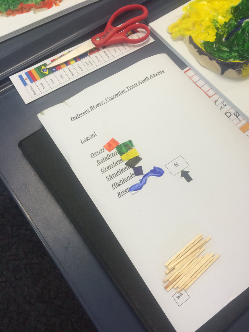
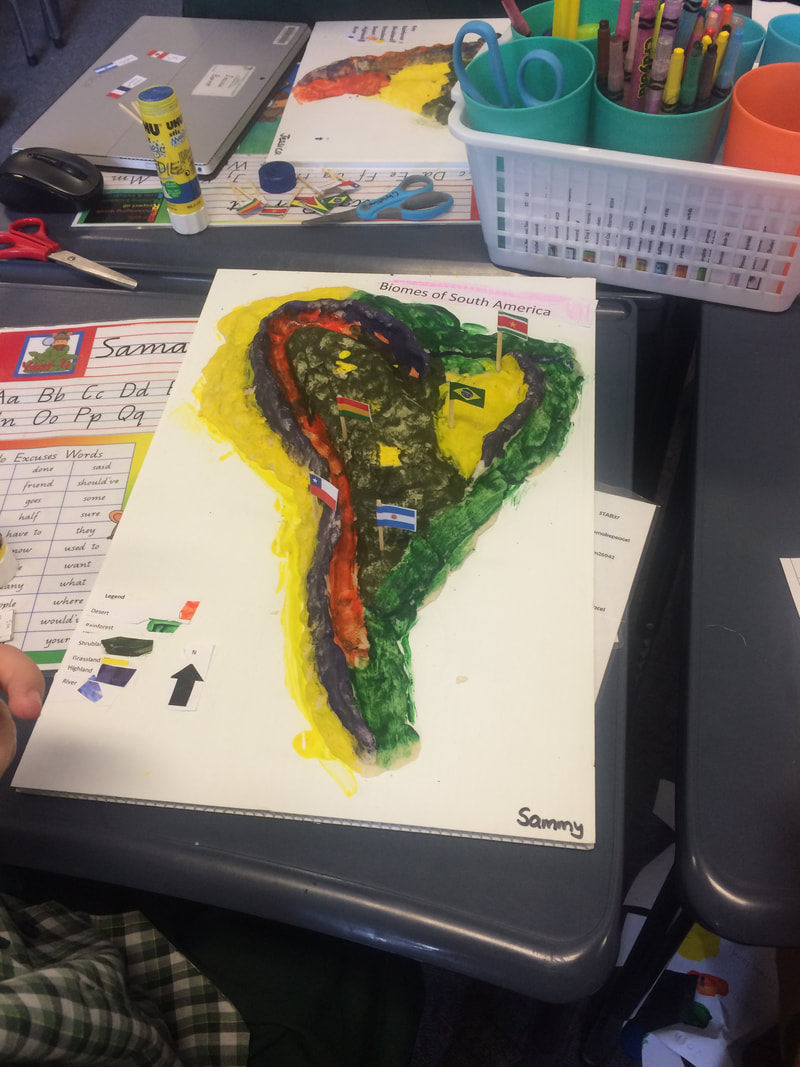
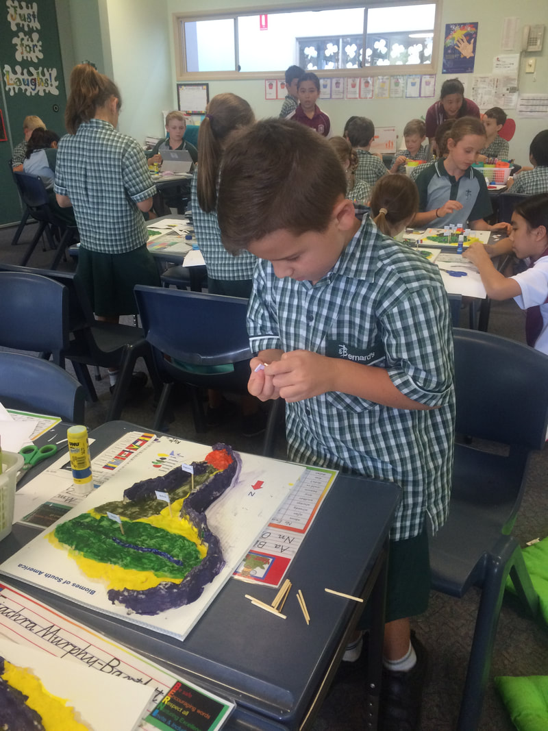
Salt Dough Maps
Students can transfer the information from the vegetation map they have created to a salt dough map. Creating a salt dough map is a very engaging and hands-on way for students to construct a map and use cartographic conventions such as legend, title and north point.
Students can transfer the information from the vegetation map they have created to a salt dough map. Creating a salt dough map is a very engaging and hands-on way for students to construct a map and use cartographic conventions such as legend, title and north point.
|
Recipes for salt dough (basically salt, flour and water) can be found on-line. Generally, the ratio is twice as much flour as salt, but since salt has a greater density than flour, by weight the amounts are almost equal. To make enough for two classes, I used 16 kg flour, 16 kg salt and four containers of cream of tartar. We added about the same volume of water as salt and added more if it seemed to dry. We mixed the dough in eight separate batches and had about one batch left over in the end.
The project was undertaken over three sessions. The first session focused on building the continent by forming land, mountain ranges, basins and rivers. During the second session, students painted their maps to show vegetation regions. They also painted samples of each colour onto a scrap of paper to be used to make the legend in the final session. In the third session, students printed a legend, north point and title and used a political map to determine the locations to put the flags. |
|
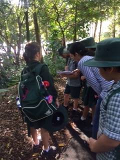
Excursion to the Botanic Gardens
A visit to the Mt Coot-tha Botanic Gardens is an opportunity to give students the opportunity to see different vegetation types in real life. The gardens are organised into geographical communities and include and arid region plants, rainforest, temperate zone and tropical dome. The Australian Rainforest near the entry to the gardens has a lot of information about how Indigenous Australians traditionally used many plants and can link with the Year 4 History curriculum topic. Each group is given a two-sided worksheet to guide their experience through the gardens. The tasks are designed to assist students in focusing their discussions throughout the day. The Mt Coot-tha Botanical Gardens has a Hide and Seek Children's Trail that highlights many interesting features that are pertinent to the Year 4 Geography curriculum. The Visitor Map is a useful example of a large-scale map for students to use. |
|
Sample Itinerary
9:30 Arrive at Mt Coot-tha Botanic Gardens
Aboriginal Rainforest Trail
10:30 Morning Tea at new playground area
(Parents can take this opportunity for a “coffee break” while the teachers supervise the students)
11:15 Parents to meet students at new playground area
11:25 Children’s Trail OR Biomes Gardens
12:15 Lunch – check in with teachers at old Lagoon lawn area
12:40 Children’s Trail OR Biomes Gardens
1:40 Meet near Information Kiosk to get ready for bus
1:50 Depart Mt Coot-tha Gardens
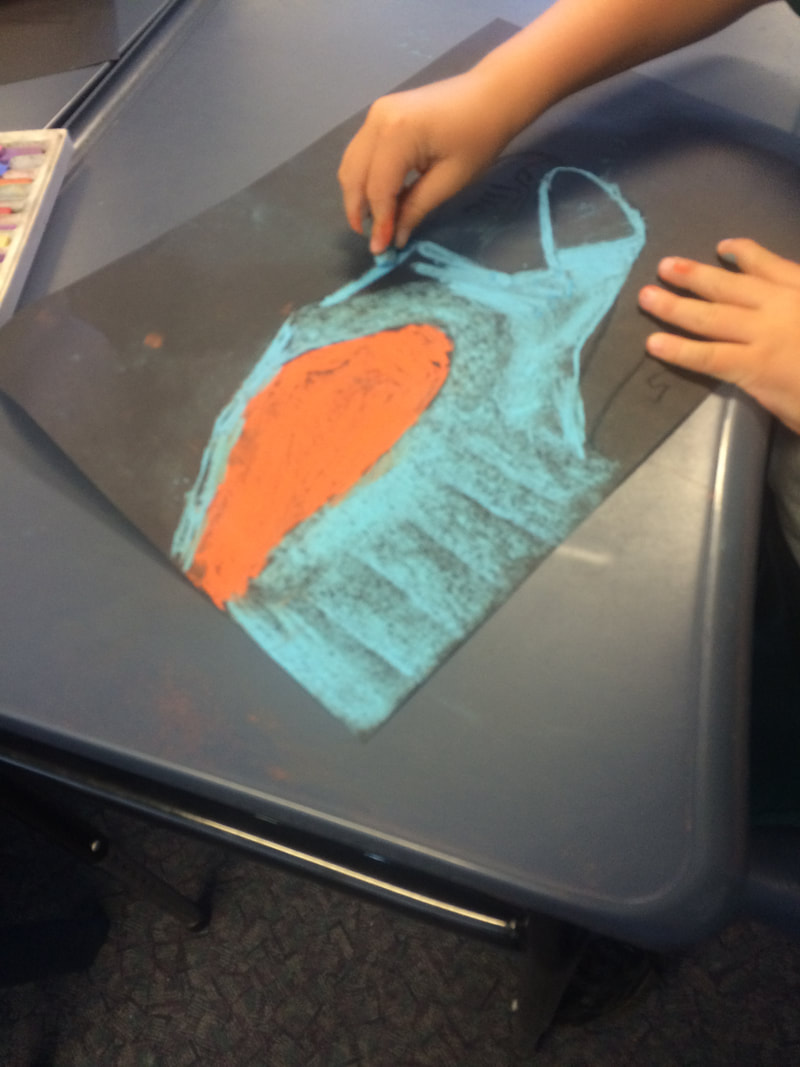
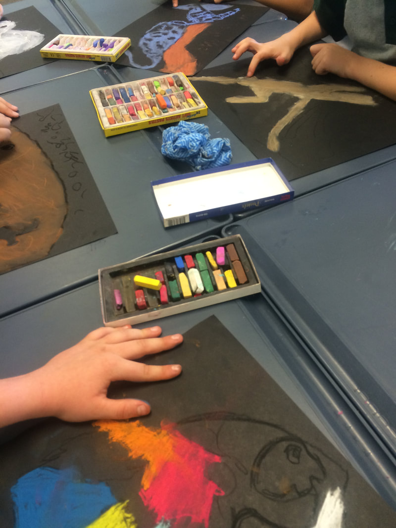
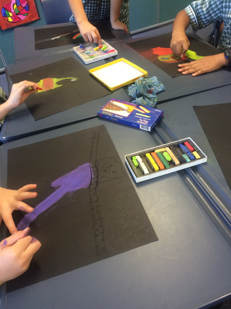
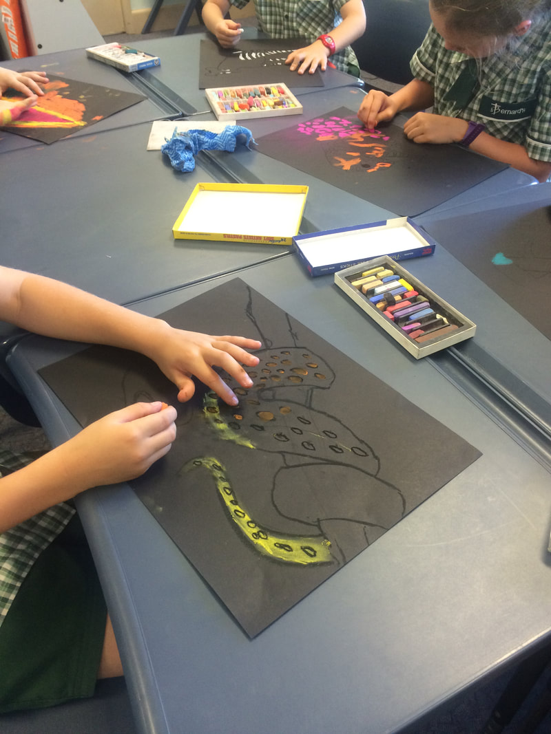
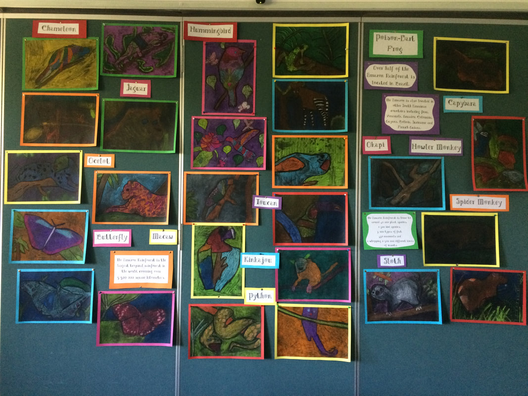
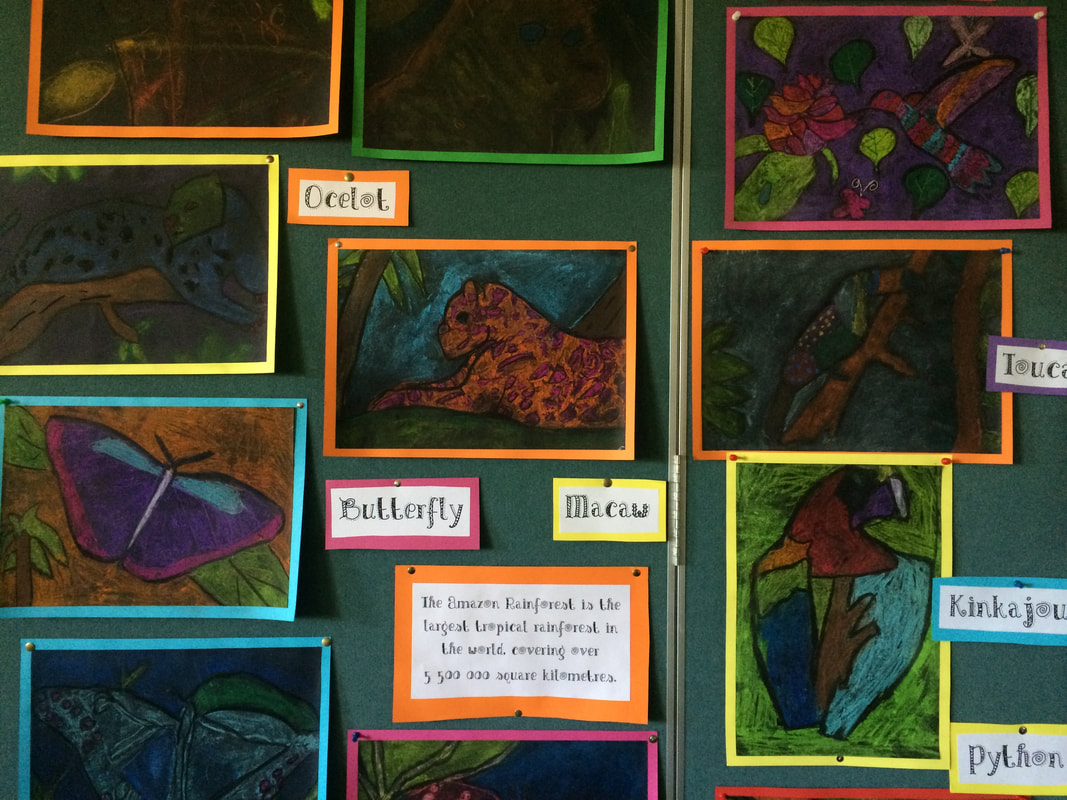
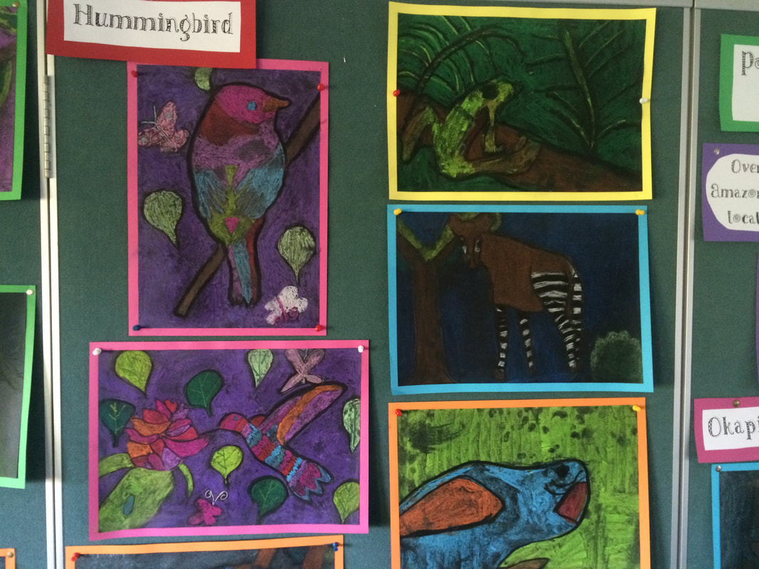
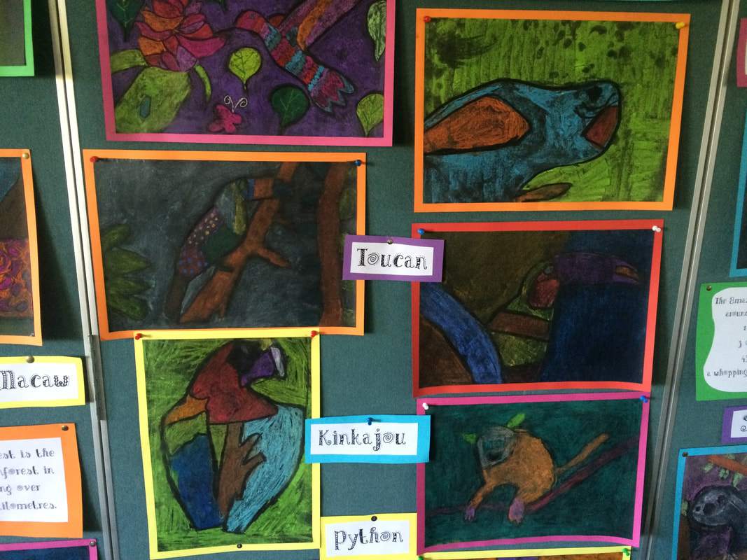
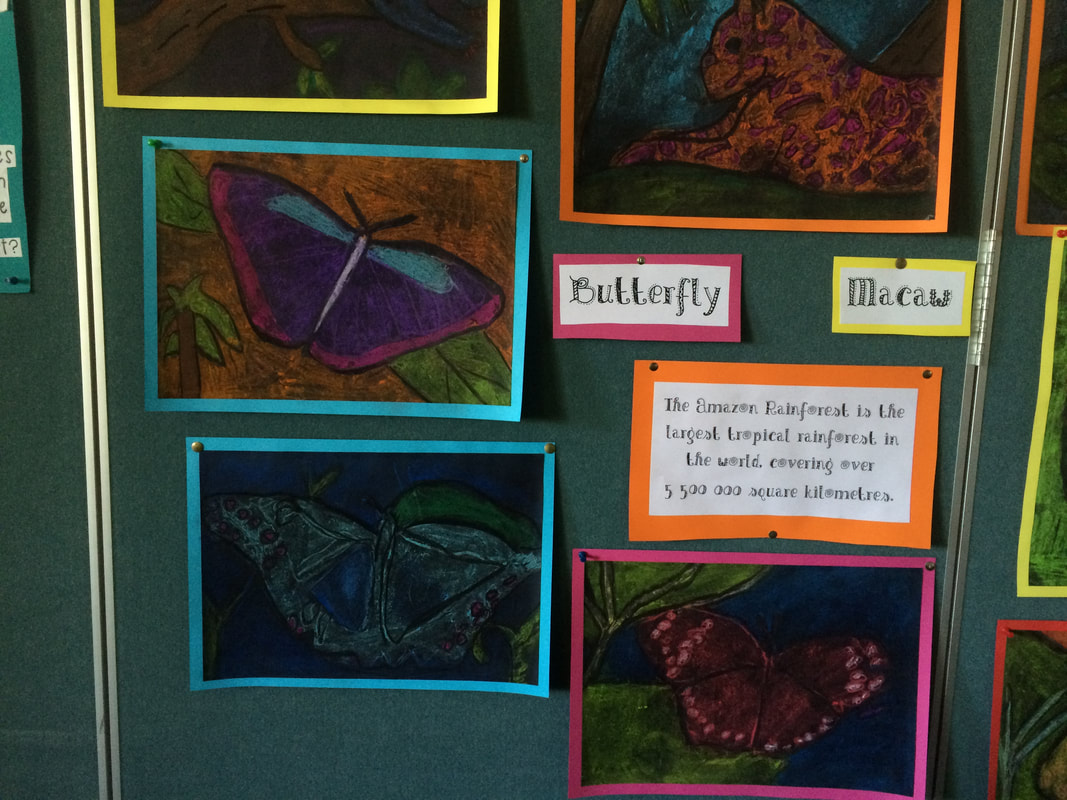
Amazon Animal Art
Students look at photographs of Amazon animals and create brightly coloured drawings using chalk pastels on black paper.
The pictures are mounted on brightly coloured paper and the names of animals are displayed with the pictures, along with some facts about the Amazon Rainforest.
Students look at photographs of Amazon animals and create brightly coloured drawings using chalk pastels on black paper.
The pictures are mounted on brightly coloured paper and the names of animals are displayed with the pictures, along with some facts about the Amazon Rainforest.